Scotland's Highlands unfold a tapestry of enchanting hikes perfect for fell walkers, traversing rugged landscapes and rich historical paths. Begin your adventure on the iconic West Highland Way, a 96-mile trail embracing the awe of Loch Lomond and the wild allure of Rannoch Moor. Enhance the experience by tackling Ben Nevis, Scotland's highest peak, offering panoramic vistas for those who embrace its challenge. For breathtaking cliffs and geological marvels, explore the Quiraing's 6.8 km circuit. Discover Glen Coe's diverse trails steeped in historical mystique or the secluded serenity of Torridon's waterfalls. Each trail promises unparalleled beauty and further discoveries await.
Key Takeaways
- The West Highland Way offers diverse landscapes and wildlife, spanning 96 miles from Milngavie to Fort William over 6-8 days.
- The Great Glen Way provides mountain and loch scenery along 79 miles from Fort William to Inverness, taking 5-6 days.
- Ben Nevis Ascent is a challenging 15.9 km hike with an elevation gain of 1,344 meters, offering panoramic Highland views.
- Glen Coe, the birthplace of Scottish mountaineering, features both challenging ascents and easier trails with rich historical significance.
- Torridon is ideal for seasoned hikers with five Munros and hidden waterfalls, offering serene and dramatic landscape views.
Iconic Highland Trails
Amidst the rugged beauty of Scotland's Highlands, the iconic trails offer a sublime fusion of nature and adventure for hiking enthusiasts.
The renowned West Highland Way, stretching 96 miles from Milngavie to Fort William, is steeped in trail history, tracing paths once traveled by drovers, warriors, and pilgrims. This beloved route, completed over 6 to 8 days, guides hikers through diverse landscapes, from the serene shores of Loch Lomond to the rugged expanse of Rannoch Moor, with opportunities to encounter native wildlife such as red deer and golden eagles.
Equally enchanting, the Great Glen Way spans 79 scenic miles from Fort William to Inverness. Over 5 to 6 days, this trail reveals the majesty of Scotland's mountain and loch scenery, including the legendary Loch Ness, where hikers might glimpse the elusive otter or osprey.
The Southern Upland Way, Scotland's longest Great Trail, offers a 212-mile journey from Portpatrick to Cockburnspath. This trail, requiring 12 to 16 days, traverses rolling hills and remote moorlands, providing a haven for nature enthusiasts and wildlife encounters with badgers and hares.
Each trail beckons with its unique blend of history and natural splendor.
Essential Hiking Gear
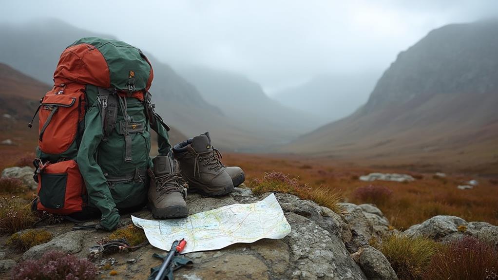
Equipping yourself with the right gear is vital for an enjoyable and safe experience on Scotland's Highland trails.
Proper footwear and layered clothing protect against the region's unpredictable weather and challenging terrain, while reliable navigation tools guarantee you can confidently explore even the most remote paths.
Additionally, maintaining hydration and energy levels is essential, so consider packing water bottles or hydration packs alongside nutritious snacks to fuel your adventure.
Footwear and Clothing
When starting on a hike through Scotland's breathtaking Highlands, selecting the right footwear and clothing is essential for a comfortable and safe adventure. The varied terrain, from rocky paths to wet conditions, demands footwear types that offer robust ankle support, reliable traction, and water resistance. Hiking boots are a popular choice for their ability to navigate rugged landscapes while protecting your feet from the elements.
Beyond footwear, choosing appropriate clothing materials is equally important. Moisture-wicking fabrics are recommended to regulate body temperature and keep you dry, critical for long hikes where weather can shift unexpectedly.
Layering your clothing is a strategic approach to tackle the Highlands' unpredictable weather and varying altitudes. A proper hiking outfit typically includes:
- Base Layer: Opt for moisture-wicking clothing to keep sweat away from the skin.
- Insulating Mid-Layer: Use fleece or wool to retain warmth in cooler conditions.
- Waterproof Outer Layer: A shell jacket protects against rain and wind.
Gaiters can also be indispensable in keeping mud and debris at bay, enhancing your overall protection.
Remember to pack spare socks to prevent blisters, ensuring foot comfort on extended treks.
Navigation and Maps
Maneuvering the vast and stunning landscapes of Scotland's Highlands is an adventure best undertaken with meticulous preparation. Effective navigation is essential for a successful journey, and mastering map reading and navigation techniques is critical for any fell walker. A detailed map is a hiker's most reliable companion, highlighting trails, elevation changes, and topographical features. This guarantees that routes are planned with precision, avoiding any unexpected detours or hazards.
While GPS devices and smartphone apps offer modern navigation conveniences, carrying a physical map is indispensable in the remote areas of the Highlands, where signal loss is common. Understanding grid references allows hikers to pinpoint their exact location, which is imperative during emergencies or when deviating from planned paths.
Familiarity with map symbols and legends is equally important; these symbols help interpret terrain features, indicating paths, water sources, and potential hazards that may arise during the hike.
Additionally, regularly checking weather conditions is paramount, as sudden changes can drastically affect visibility and trail safety. By integrating these navigation techniques, hikers can confidently explore the Highlands, guaranteeing an enriching and safe experience amidst Scotland's breathtaking natural beauty.
Hydration and Snacks
Proper hydration and nutrition are fundamental aspects of any successful hiking expedition in Scotland's Highlands. The rugged terrains and unpredictable weather demand meticulous hydration strategies to maintain energy levels.
It's recommended to consume at least 2-3 liters of water daily, vital during strenuous hikes on trails such as the West Highland Way or the Great Glen Way. A lightweight, reusable water bottle or a hydration bladder is indispensable for easy access to water on these lengthy excursions.
Equally important is the selection of snacks that fuel these adventures. High-energy, portable snacks, rich in carbohydrates and protein, are essential for sustained stamina. Options like trail mix, energy bars, or jerky provide quick energy boosts, perfect for demanding hikes such as the Three Lochs Way.
These snack selections are not only lightweight but also convenient for on-the-go consumption, ensuring you remain energized for physically challenging routes like the Ring of Steall or the Fisherfields Round.
To enhance your overall hiking experience, consider the following tips:
- Plan regular hydration and snack breaks to prevent fatigue and maintain morale.
- Choose snacks that are easy to carry and consume on the trail.
- Equip yourself with a reliable hydration system for efficient water access.
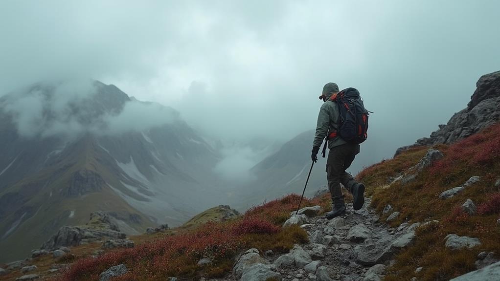
Ben Nevis Ascent
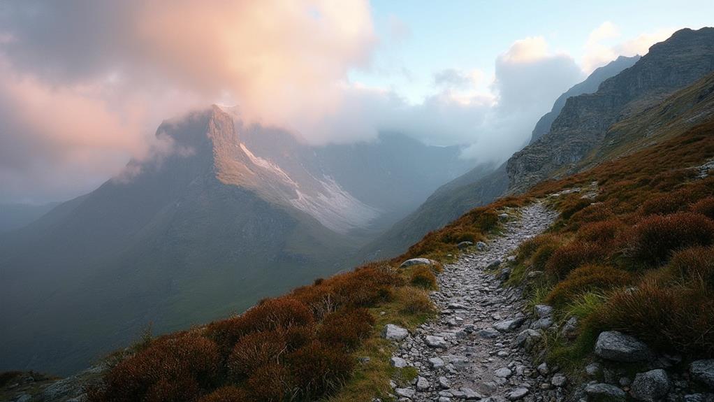
The Ben Nevis Ascent is a formidable challenge, with the Mountain Track spanning 15.9 kilometers and classified as a hard difficulty hike, demanding both physical endurance and mental resilience.
Essential gear such as sturdy boots and weather-appropriate clothing is vital, as the route presents rocky terrain and unpredictable weather changes.
Despite the demanding journey, reaching the summit rewards hikers with breathtaking panoramic views, making it a popular pursuit for outdoor enthusiasts enthusiastic to conquer the UK's highest peak.
Trail Difficulty Levels
Ben Nevis's ascent presents a formidable challenge for avid hikers, demanding both physical endurance and mental fortitude.
The Ben Nevis Mountain Track is classified under a hard difficulty trail grading, spanning 15.9 km (9.9 miles) with an impressive ascent of approximately 1,344 meters (4,409 feet). For those evaluating their skills, this track tests both stamina and navigation abilities.
The rugged landscape and steep, rocky terrain make it essential for hikers to be well-prepared, as the path, while well-marked, requires sharp navigation skills, particularly in adverse weather conditions.
As the UK's highest peak, Ben Nevis demands meticulous preparation and a thorough understanding of the trail's challenges. Here are key difficulty aspects to reflect on:
- Duration: On average, the ascent takes around 7 hours and 22 minutes from Glen Nevis Youth Hostel to the summit, so plan your day accordingly.
- Terrain: Be ready for steep and rocky sections that necessitate proper footwear and safety gear.
- Weather Preparedness: Ben Nevis's weather is notoriously unpredictable, making it vital to check forecasts and prepare for sudden changes in climate, ensuring a safe and enjoyable hike.
Essential Gear Recommendations
Starting on the ascent of Ben Nevis requires careful preparation and specific gear to guarantee both safety and comfort. Proper footwear is fundamental, with sturdy hiking boots offering essential grip and support on the challenging rocky terrain.
To navigate the unpredictable weather, a waterproof and windproof jacket is indispensable, ensuring warmth and dryness through sudden changes, even during summer. Mastering layering techniques with moisture-wicking base layers and insulating mid-layers enhances comfort and adaptability to temperature fluctuations.
Carrying ample water, at least 2-3 liters, is essential for staying hydrated throughout the demanding 7-8 hour journey. Trekking poles are recommended to maintain balance and alleviate stress on the knees during steep sections, greatly enhancing stability and reducing fatigue.
Additionally, gear maintenance is critical; ensuring boots are waterproofed and trekking poles are in good condition can prevent equipment failure during the hike.
A well-stocked backpack should include high-energy snacks, a first aid kit, a map, compass, and a fully charged mobile phone, all necessary for navigation and handling unforeseen emergencies.
Scenic View Highlights
As hikers commence on the ascent of the UK's tallest peak, Ben Nevis, they are rewarded with breathtaking scenic views that unfold along the journey, culminating in a panoramic vista at the summit.
The climb, which typically spans a distance of 15.9 kilometers (9.9 miles) and takes approximately 7 hours, provides a spectacular array of mountain vistas that captivate any nature enthusiast. On clear days, the view extends over the vast expanse of the Highlands and reaches as far as Loch Ness, offering a visual feast that makes every steep gradient worthwhile.
Beyond the remarkable landscapes, the ascent presents opportunities for unique wildlife encounters. The trail is a haven for rare mountain plants and the majestic presence of red deer and golden eagles.
As hikers progress along the well-marked yet challenging path, they can appreciate the diversity of flora and fauna that thrive in this rugged environment.
At the peak, visitors are greeted by a stone cairn and a historic weather station, elements that emphasize Ben Nevis's significance.
Here are three highlights during the ascent:
- Panoramic views of the Highlands and Loch Ness
- Sightings of rare mountain plants and wildlife
- Historic weather station and stone cairn at the summit
The Quiraing Adventure
Nestled within the dramatic landscapes of the Isle of Skye, the Quiraing Adventure offers hikers a mesmerizing journey through Scotland's ancient geological wonders. This 6.8 km circuit is renowned for its stunning vistas shaped by historic landslips, providing an unparalleled setting for landscape photography.
The trail, rated 4.8 for difficulty, presents a moderate challenge suitable for both casual walkers and seasoned hikers, with breathtaking views of towering cliffs and distinctive rock formations.
The Quiraing is part of the Trotternish Ridge and serves as a sanctuary for nature enthusiasts. As hikers traverse the path, they can indulge in wildlife spotting, with the area boasting a rich array of flora and fauna.
Iconic landmarks such as the Needle, the Table, and the Prison dot the trail, each offering unique perspectives and excellent photography opportunities. Completing the hike typically takes about 4 to 5 hours, allowing ample time to savor the extraordinary scenery.
This adventure through the Quiraing is more than just a hike; it is an exploration of the natural artistry sculpted by time, providing both a visual feast and an invigorating outdoor experience.
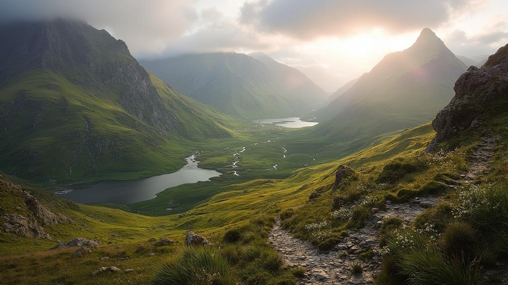
Discovering Glen Coe
Amidst the storied landscapes of Scotland, Glen Coe stands as a monument to both natural beauty and historical significance. Known as the birthplace of Scottish mountaineering, this National Nature Reserve offers a diverse array of hiking opportunities.
From the challenging ascents of Aonach Eagach and the Three Sisters to more leisurely walks like the Signal Rock trail, Glen Coe caters to both seasoned adventurers and casual walkers. Its eight Munros beckon experienced hikers seeking to conquer Scotland's iconic peaks, while the easier paths allow everyone to witness the grandeur of its steep valleys and rugged mountains.
The area is also rich with historical landmarks, most significantly tied to the infamous Glencoe Massacre. This tragic event from the late 17th century enriches the hiking experience with a profound cultural narrative, adding layers of depth to the already stunning scenery.
As you traverse these paths, it is not uncommon to encounter the diverse mountain wildlife that calls Glen Coe home, further enhancing the allure of this extraordinary landscape.
Must-See Highlights of Glen Coe:
- Aonach Eagach Ridge – For a thrilling mountaineering experience.
- Signal Rock – Accessible trails with historical significance.
- The Three Sisters – Iconic peaks offering breathtaking views.
Scenic Loch Lomond Paths
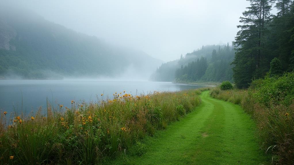
With its enchanting blend of tranquil waters and lush landscapes, Loch Lomond serves as a mesmerizing setting for some of Scotland's most scenic hiking paths. This region, a haven for nature enthusiasts, offers trails that are as diverse as they are fascinating.
The Loch Lomond & Cowal Way, a 57-mile journey from Portavadie to Inveruglas, showcases dramatic forests and serene shorelines, inviting hikers to immerse themselves over 3 to 5 days in the area's natural splendor and diverse Loch Lomond wildlife.
For a slightly shorter adventure, the Three Lochs Way spans 34 miles, enveloping travelers in the breathtaking scenery of the Loch Lomond region over 2 to 3 days. This route offers glimpses of the region's rich biodiversity, as well as opportunities to appreciate historical landmarks dotting the landscape.
Meanwhile, Ben Lomond stands as a towering sentinel at 974 meters, offering panoramic vistas that attract artists and outdoor enthusiasts alike.
The Ardess Hidden History Trail provides a more leisurely exploration, taking hikers on a low-level path through the area's historical landmarks, allowing for a deeper appreciation of Loch Lomond's cultural heritage.
Each path promises an unforgettable journey through one of Scotland's most cherished landscapes.
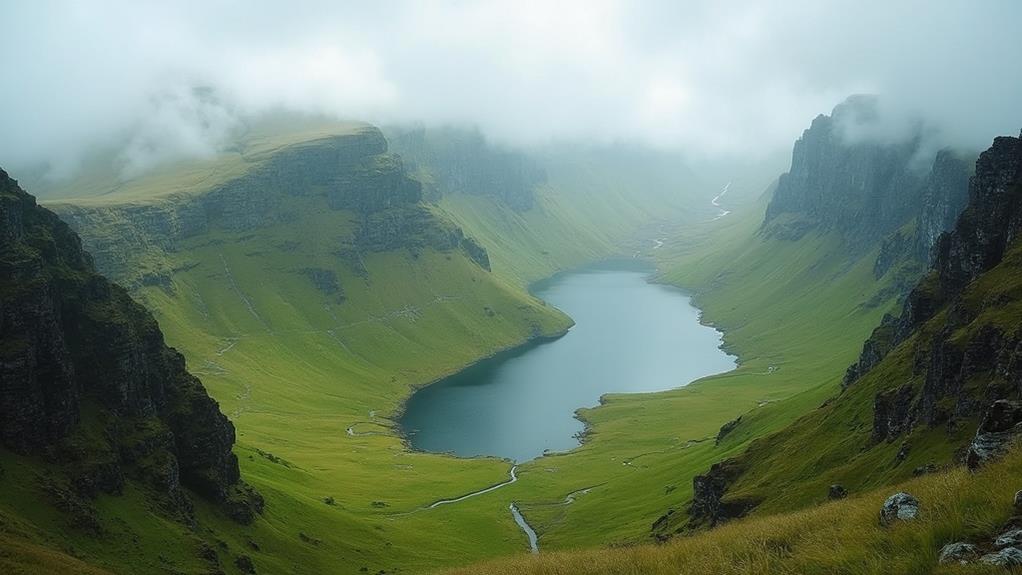
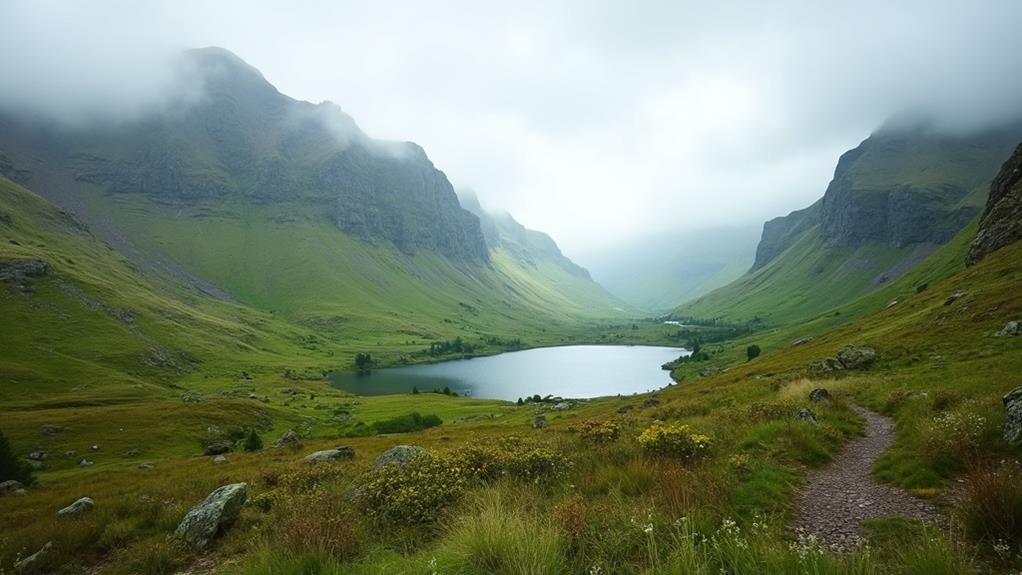
Hidden Gems of Torridon
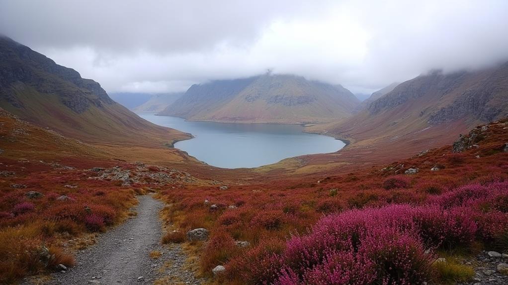
Torridon, a mountainous haven in the Scottish Highlands, captivates adventurers with its breathtaking landscapes and five majestic Munros that challenge even seasoned hikers.
Beyond its renowned peaks, Torridon conceals a myriad of hidden gems that promise to enchant and invigorate explorers seeking unique experiences. Among these treasures are hidden waterfalls, tumbling gracefully through secluded glens, offering serene spots for contemplation amidst nature's symphony.
Visitors can uncover secret viewpoints, providing sweeping vistas of the rugged Torridon landscape. These vantage points serve as perfect perches to appreciate the area's diverse wildlife and striking geological formations, highlighting the intricate tapestry of the region's natural history.
For those yearning for tranquility, Loch Torridon's shores are ideal for scenic picnics, where the calming waters complement the dramatic backdrop of towering peaks.
To truly experience Torridon's hidden gems, consider these must-see spots:
- Coire Mhic Fhearchair: A remote corrie renowned for its dramatic cliffs and tranquil loch, perfect for hiking and photography.
- The Horns of Beinn Alligin: A thrilling ridge walk offering panoramic views and a sense of adventure.
- Flowerdale Glen: A picturesque trail leading to hidden waterfalls and lush woodlands, ideal for nature enthusiasts.
Discovering Torridon's hidden gems reveals the untamed beauty of Scotland's Highlands.
Kintail's Five Sisters
Nestled in the heart of the Scottish Highlands, the Five Sisters of Kintail often captivate those who seek the thrill of the climb and the allure of nature's grandeur. This renowned mountain range, characterized by its sharp, rugged peaks, presents summit challenges that both test and reward the seasoned hiker.
Comprising five Munros, the range offers a compelling invitation to conquer multiple summits in one invigorating outing. The trails, accessible to various skill levels, provide breathtaking views of the surrounding landscapes and glens, ensuring a memorable journey through one of Scotland's most majestic terrains.
As hikers traverse the dramatic terrain of the Five Sisters, they are treated to more than just panoramic vistas. This area, celebrated as part of the Kintail National Scenic Area, is rich in wildlife encounters.
Enthusiasts might spot red deer gracefully maneuvering the slopes, or golden eagles soaring above, each sighting adding to the adventure's allure. Unique geological formations further enhance the experience, offering glimpses into the ancient forces that shaped these majestic peaks.
Preparing for Highland Weather
Anyone planning a hike in the Scottish Highlands must be ready to tackle the region's famously unpredictable weather. The climate can shift rapidly, transforming a sunny day into a misty, rain-soaked adventure. For ideal weather preparedness, hikers should consult the Mountain Weather Information Service for real-time updates before setting out. This guarantees that trail safety is prioritized, as being caught unprepared in adverse weather can pose serious risks.
To effectively prepare for the Highlands' capricious conditions, consider the following essentials:
- Clothing: Pack a reliable windbreaker and warm layers, especially for high-altitude trails where temperatures can plummet unexpectedly.
- Timing: Start early on popular trails to secure parking and minimize the risk of encountering severe weather later in the day.
- Provisions: Maintain energy levels with ample hydration and snacks, as extended hiking times due to unpredictable weather can lead to fatigue.
In addition to these preparations, familiarize yourself with critical trail safety tips, such as carrying a map and compass, and identifying alternative routes suitable for varying experience levels.
Such meticulous preparation guarantees not only an enjoyable hiking experience but also enhances safety amidst the Highlands' stunning yet demanding environment.
Frequently Asked Questions
What Is the Most Scenic Walk in Scotland?
Scotland's most scenic walk is the Quiraing Circuit on the Isle of Skye. This breathtaking trail features unique landscapes, offering panoramic scenic viewpoints and opportunities for enchanting wildlife encounters, making it an essential experience for nature enthusiasts.
What Is the Most Difficult Walk in Scotland?
The most difficult walk in Scotland is the Cape Wrath Trail, encompassing technical challenges such as remote terrain and navigation. Preparation tips include mastering map reading, ensuring physical fitness, and carrying essential survival gear for this demanding adventure.
What Is the Famous Hiking Trail in Scotland?
The West Highland Way is Scotland's renowned hiking trail, offering an immersive journey through the country's rich cultural heritage. Hikers experience diverse wildlife encounters amidst stunning landscapes, from Loch Lomond to the foot of Ben Nevis, enriching every step.
What Is the Big Walk in Scotland?
The "Big Walk" in Scotland is the Southern Upland Way, a notable Highland trail. Spanning 212 miles, it demands careful weather considerations, offering diverse landscapes and a profound exploration of Scotland's natural beauty and cultural richness.
Conclusion
The Scottish Highlands offer an unparalleled tapestry of trails that cater to both seasoned fell walkers and enthusiastic novices. From the majestic ascent of Ben Nevis to the enchanting landscapes of The Quiraing and Glen Coe, each path promises a unique encounter with nature's grandeur. Scenic routes around Loch Lomond, the hidden gems of Torridon, and the challenging Kintail's Five Sisters further enhance this exploration. Adequate preparation and gear guarantee a memorable and safe hiking experience amidst the Highlands' unpredictable weather.