Advanced navigation involves integrating maps, compasses, and GPS for precise orientation. By understanding geodetic datums and the UTM grid system, users can enhance spatial accuracy. Setting the GPS datum to match map datum reduces error. GPS complements traditional navigation, offering the benefit of advanced positioning while a compass provides reliable directional data independent of power. Map and compass interpretation enhances terrain awareness, crucial in GPS signal outages. To conserve power, intermittently deactivate the GPS after confirming location. Mastering these tools guarantees independence and safety across varied terrains and environments. Explore further to refine these essential skills.
Key Takeaways
- Integrate GPS with traditional map reading to improve landscape orientation and navigation accuracy.
- Match GPS and map datums to minimize navigation errors exceeding 200 meters.
- Use the UTM grid system for precise location determination with easting and northing coordinates.
- Regularly switch off GPS after location determination to conserve battery and enhance traditional skills.
- Employ power-saving strategies and carry alternative power sources for continuous GPS operation.
Importance of Traditional Navigation
Traditional navigation, employing maps and compasses, remains an important skill set for providing an extensive geographic context that digital devices alone cannot offer. By leveraging traditional skills, individuals gain a thorough understanding of the terrain, enhancing their situational awareness. This method allows users to interpret landscape features, such as elevation changes and natural barriers, that may not be fully captured on a digital screen.
Integrating traditional navigation with modern GPS technology can greatly improve navigation accuracy. When users align the digital coordinates from a GPS device with the grid on a physical map, they guarantee precise positioning, minimizing errors. This process requires familiarity with geodetic datums, which are fundamental to match the map's reference system with the GPS data.
Moreover, reliance on traditional skills fosters navigation confidence, particularly in scenarios where GPS devices may fail due to battery issues or signal loss. This self-reliance is vital during outdoor activities in remote areas, where technology alone may not suffice.
Consequently, mastering traditional navigation not only supplements digital methods but also empowers individuals to navigate effectively and independently, promoting safety and efficiency in diverse environments.
Limitations of GPS Devices

In the domain of advanced navigation, GPS devices present specific limitations that users must consider.
The dependency on battery power poses challenges, particularly during extended excursions in areas lacking recharging facilities. Additionally, the constrained screen size of these devices can impede the user's ability to analyze thorough geographic contexts, while budget models often sacrifice advanced mapping features, further restricting navigational precision.
Battery Dependency Challenges
One significant limitation of GPS devices is their dependency on battery power, which poses challenges for extended use during prolonged trips or in remote locations where recharging options are scarce. Typically, GPS devices offer a battery life ranging from 12 to 20 hours on a single charge. This constraint necessitates effective battery longevity solutions to guarantee continued functionality.
Users can mitigate power consumption by employing energy-saving strategies, such as disabling the GPS feature once the current position is determined, allowing navigation via a map and compass which do not require power.
Moreover, cold weather conditions are known to exacerbate battery depletion, potentially halving the operational time of GPS devices. In such environments, alternative power sources become vital. Solar chargers, portable battery packs, and hand-crank generators are viable options, providing additional energy reserves to sustain GPS operation during extended periods without access to conventional power outlets.
In preparing for navigation in challenging terrains, understanding the limitations of GPS battery life is essential. Incorporating these power management techniques guarantees that GPS devices remain a reliable tool alongside traditional navigation methods, such as maps and compasses, enhancing overall navigational strategy and safety.
Screen Size Limitations
A notable limitation inherent in many GPS devices is their constrained screen size, which often impedes the user's ability to visualize detailed geographic features and terrain context effectively. The restricted screen dimensions can greatly influence screen resolution effects, affecting the clarity and detail of the displayed navigational maps. This limitation poses visual navigation challenges, as key features such as contour lines, landmarks, and route details may be difficult to discern. Consequently, users may need to frequently zoom in and out to capture relevant information, a process that can interrupt the fluidity of navigation and planning.
| Aspect | Impact on Navigation |
|---|---|
| Screen Size | Reduces visibility of detailed geographic features |
| Screen Resolution Effects | Impairs clarity of complex terrain and features |
| Visual Navigation Challenges | Disrupts seamless route planning and obstacle identification |
Moreover, the limited display area may lead to misinterpretations of spatial relationships and distances, particularly in intricate landscapes where precise navigation is vital. These challenges highlight the importance of supplementing GPS use with physical maps, which offer a thorough view of the terrain, thereby addressing the constraints imposed by screen size. By integrating traditional maps, users can enhance their situational awareness and compensate for the visual limitations of GPS devices, ensuring more accurate and reliable navigation.
Mapping Feature Restrictions
Among the many constraints faced by GPS devices, mapping feature restrictions stand out as significant hurdles for effective navigation. Limited screen sizes often inhibit the visibility of thorough geographic contexts, which can detract from the user's ability to make informed navigation decisions when compared to traditional detailed maps. This limitation is exacerbated in budget-friendly models like the Garmin eTrex SE, which frequently lack thorough mapping features. Such deficiencies can pose significant challenges in unfamiliar terrains where detailed map data is vital.
Moreover, the dependency on battery power presents a precarious situation, as GPS devices become ineffective when batteries deplete, potentially leaving users stranded without reliable navigation tools. In addition, inaccuracies can arise if the GPS datum does not align with the corresponding map's datum, leading to navigation errors exceeding 200 meters. This highlights the necessity for proper settings calibration to guarantee precise location data.
To mitigate these limitations, once an exact location is pinpointed using GPS, it is prudent to turn the device off to conserve battery life. Shifting to a map and compass not only preserves power but also encourages proficiency in using advanced navigation tools, further augmented by potential mapping feature enhancements.
Benefits of Map and Compass

Utilizing maps and compasses offers a multitude of advantages for wayfinding enthusiasts and professionals alike. Mastering map reading enhances terrain awareness, enabling individuals to devise effective route strategies for complex outdoor adventures.
With precise compass skills, users can execute accurate route planning and wayfinding techniques, essential for field navigation. The integration of these skills into hiking essentials not only enriches outdoor experiences but also bolsters survival skills by reducing dependency on electronic devices.
Maps provide a thorough geographic context that surpasses the limited scope of a GPS screen. This broader perspective is vital for situational awareness, allowing for informed decision-making during excursions.
When combined with compass skills, users gain the ability to determine precise courses and directions, even in technology-free scenarios, such as conserving GPS battery life in remote locations.
Employing a 1:50,000 scale map with compass grid reference overlays enhances accuracy in location finding. This technical approach involves measuring distances from designated grid lines, ensuring precise wayfinding.
An understanding of the UTM grid system further refines these capabilities, utilizing easting and northing values to accurately pinpoint positions. These skills collectively promote self-reliance, offering invaluable expertise for traversing challenging terrains.
Enhancing Navigation Accuracy
To enhance navigation accuracy, integrating GPS technology with traditional map reading provides a thorough approach to landscape orientation and situational awareness. This synergistic method guarantees a detailed understanding of the terrain, vital for effective route planning and terrain assessment.
A key factor in this integration is setting the GPS datum to match the map's datum, such as NAD 27 or NAD 83, minimizing potential errors that can exceed 200 meters. Such alignment is essential for precise navigation, particularly when utilizing a 1:50,000 scale map which allows for detailed measurements.
Accurate navigation begins with determining one's position on the UTM grid using easting and northing coordinates, confirming alignment with the map's grid system. This process facilitates precise positioning and a better understanding of one's surroundings.
Regularly turning off the GPS after determining the location not only conserves battery life but also encourages the development of traditional navigation skills, such as using a compass and map reading.
Understanding Geodetic Data
Understanding geodetic data is fundamental for precise navigation and mapping accuracy. Geodetic datums are reference systems that precisely define feature positions on maps. Modern geodetic advancements, such as NAD 83 and WGS84, leverage satellite technology, achieving unprecedented accuracy. In contrast, earlier datums like NAD 27 relied on regional surveys, often resulting in significant datum comparison discrepancies. Such mismatches can cause errors exceeding 200 meters, highlighting the significance of aligning map datums with GPS settings.
The Universal Transverse Mercator (UTM) grid system further enhances navigation precision. It divides the Earth into 60 zones, each utilizing a 1 km square grid based on the Transverse Mercator projection. This minimizes distortion, ensuring topographic map accuracy. UTM coordinates, consisting of easting and northing values, always list easting first, with the Central Meridian for each zone standardized at 500,000 meters.
| UTM System Feature | Description |
|---|---|
| Zones | 60 global zones |
| Grid Size | 1 km square |
| Projection Type | Transverse Mercator |
| Central Meridian | 500,000 meters for each zone |
Correctly adjusting GPS settings to match the map's datum and understanding the grid system are essential for effective navigation and accurate location determination. These elements underscore the importance of geodetic data in modern cartography.
Aligning GPS With Maps

Aligning GPS data with maps is a critical component of advanced navigation, requiring precise attention to datum compatibility, such as ensuring the GPS datum matches the map's datum (e.g., NAD 27 or NAD 83) to prevent errors exceeding 200 meters.
Mastery of the UTM grid system is essential, as it provides a standardized framework of easting and northing coordinates, where the easting value (e.g., 029 5103) must be recorded before the northing (e.g., 53 64712) for accurate position plotting.
Additionally, understanding the positioning relative to the UTM zone's central meridian—set at 500,000—is crucial, as it helps determine whether a location is east or west, further enhancing map-reading accuracy.
Matching Datums for Accuracy
For precise navigation, aligning your GPS datum with the map's datum is paramount, as any discrepancy can result in errors exceeding 200 meters. Datum compatibility is essential for achieving GPS precision.
Geodetic datums, such as WGS84 used by most GPS devices and NAD 27 or NAD 83 found in various maps, define the mathematical model of the Earth's shape. When these datums do not match, the coordinates derived from GPS can be misaligned with map locations, leading to significant navigation errors.
To guarantee datum compatibility, identify the datum printed on your map, often found in the map legend or border. Adjust your GPS settings accordingly, selecting the corresponding datum from the device's menu. This adjustment is vital when moving between different maps, as each may adhere to distinct datums, especially older maps which often use NAD 27.
Additionally, confirm that your GPS settings reflect the specific grid system employed by the map. This includes verifying the datum setting, which is integral to the coordinate system the map uses.
Attention to these details guarantees that your GPS readings align accurately with the map's grid, facilitating reliable navigation in diverse terrains.
UTM Grid Understanding
How does one achieve precise navigation using the UTM grid system? The UTM (Universal Transverse Mercator) grid system is a robust framework for location referencing, utilizing easting and northing values for precision.
To operate efficiently within this system, understanding UTM subzones is essential. Each UTM zone, numbered from 1 to 60, is further divided into subzones, which accommodate the Earth's curvature and allow for accurate position determination globally.
UTM mapping techniques involve referencing the Central Meridian of each zone, set at 500,000 meters. Locations west of this meridian have easting values below 500,000, facilitating accurate positional calculations.
When integrating GPS data with a UTM map, the datum setting on the GPS device must match that of the map (such as NAD 27 or NAD 83) to prevent positional discrepancies that could exceed 200 meters.
Navigators must adeptly count grid lines horizontally and measure distances from these lines to pinpoint their exact location.
Mastery of these techniques, coupled with UTM subzones explanation, enhances navigators' ability to interpret and traverse complex terrains, ensuring alignment between traditional maps and GPS technology for seamless navigation.
Coordinate Alignment Techniques
Mastering the UTM grid system lays the groundwork for the precise alignment of GPS data with maps, a key component in effective navigation. This involves understanding coordinate transformation methods and datum conversion techniques. Aligning GPS data with a map's datum is vital; discrepancies can lead to navigation errors exceeding 200 meters, especially if a map based on NAD 27 is used while the GPS is set to a different datum. Confirming that both GPS and map datum settings are identical is essential for precision.
UTM coordinates, represented by easting and northing values, require careful interpretation. The easting is always listed first, aiding systematic location identification on the grid. Accurate navigation also involves measuring distances from significant grid lines, typically starting from the map's bottom left corner. Utilizing coordinate transformation methods, one can translate GPS data into the map's framework seamlessly.
| Key Element | Description | Importance |
|---|---|---|
| UTM Grid System | Easting and northing coordinate structure | Facilitates systematic positioning on maps |
| Datum Conversion | Matching GPS and map datums | Prevents significant location discrepancies |
| Coordinate Alignment | Aligning GPS data with map coordinates | Guarantees precise navigation and accurate positioning |
Geodetic Datums Overview

Geodetic datums serve as fundamental reference frameworks essential for achieving precise geographic positioning by defining the measurement and representation of the Earth's surface on maps.
Geodetic systems have evolved markedly over time, reflecting advancements in technology and survey methodologies. Early datums, such as the North American Datum of 1927 (NAD 27), relied on local survey systems that were inherently limited by the precision of terrestrial measurements. These systems were primarily based on a network of triangulation points that provided a regional perspective, often resulting in inaccuracies when applied globally.
In contrast, modern datum evolution has embraced satellite technology, leading to the development of highly accurate global frameworks like the North American Datum of 1983 (NAD 83) and the World Geodetic System of 1984 (WGS84).
These contemporary systems utilize data from satellite geodesy, greatly enhancing positional accuracy and uniformity across different regions. The precision of these datums is pivotal when integrating GPS data, as using the incorrect datum can result in navigation errors exceeding 200 meters.
As a result, an understanding of geodetic datums and their evolution is vital for ensuring compatibility between GPS devices and map data, thus facilitating accurate navigation and geographic analysis.
UTM Grid System Basics
Building on the foundational understanding of geodetic datums, the Universal Transverse Mercator (UTM) grid system offers a precise method for representing geographic locations on a global scale. This system divides the Earth into 60 distinct zones, each spanning six degrees of longitude, enabling accurate grid navigation. The UTM grid utilizes a Transverse Mercator projection, minimizing distortion and making it ideal for detailed topographic mapping.
The core of UTM applications lies in its systematic approach to positioning, employing a grid of 1 km squares. Each UTM coordinate comprises easting and northing values, critical for determining exact locations. The easting value precedes the northing, with the central meridian of each zone set at 500,000 easting. Values below this reflect positions west of the central meridian, providing clarity in identifying east-west positioning within a zone.
For practical grid navigation, users measure distances from grid lines on UTM maps. Significant grid lines, indicated by larger font numbers, serve as reference points, facilitating the accurate determination of coordinates.
This precision renders the UTM grid system indispensable for tasks requiring meticulous spatial analysis and navigation, such as military operations, surveying, and expeditions.
UTM Coordinates Explained
The UTM coordinate system is a precise method for representing geographic locations using a combination of easting and northing values, which correspond to distances from a central meridian and the equator, respectively.
Understanding how to interpret these values is essential for accurately identifying positions on a map, as each UTM zone spans 6 degrees of longitude and is structured to minimize distortion with a central meridian set at 500,000 meters.
To effectively locate a position, navigators must accurately measure distances from the nearest grid lines within the UTM grid system, which divides the globe into 1 km squares, thereby facilitating precise navigation.
Understanding UTM Coordinate System
Understanding the UTM (Universal Transverse Mercator) coordinate system is essential for accurate map reading and navigation. Originating in the mid-20th century, the UTM system was developed to address the limitations of previous mapping techniques. It minimizes distortion by dividing the earth into 60 longitudinal zones, each with a width of 6 degrees. This division allows for precise mapping applications, such as military operations, surveying, and geocaching, providing a universal standard for consistent map referencing.
Key aspects of the UTM system include:
- Zone Division: The UTM grid covers the entire world using a 1 km square grid. By dividing the globe into 60 zones, it reduces shape distortion, enhancing mapping accuracy.
- Coordinate Expression: UTM coordinates consist of easting and northing values. Easting indicates the distance from the central meridian, set at 500,000 meters, while northing represents the distance from the equator.
- Precise Location Identification: The combination of subzone, easting, and northing values allows for accurate identification of positions on maps, making it indispensable for applications requiring precision.
Understanding these components is vital in leveraging the UTM system for reliable and precise navigation.
Interpreting Easting and Northing Values
Maneuvering with precision often hinges on the ability to accurately interpret easting and northing values within the UTM coordinate system. Easting interpretation involves understanding that these values indicate the distance in meters east from the central meridian of a designated UTM zone, which is 6 degrees of longitude wide. The central meridian is set at 500,000 meters to avoid negative numbers, which aids in maintaining straightforward calculations.
For instance, an easting of 29,510 meters suggests a precise distance eastward from the central reference line.
Northing significance, on the other hand, pertains to the distance in meters north from the equator. This metric is essential for determining a location's precise latitude position within a UTM zone.
For example, a northing value of 53,64712 meters indicates a location's specific distance from the equatorial line, allowing for accurate plotting on 1:50,000 scale maps.
Understanding these components enables users to precisely identify and measure their position on a UTM grid, facilitating effective navigation. This precision is indispensable for professionals engaging in activities requiring exact location determination, such as cartography, surveying, and tactical operations, where even minor misinterpretations could lead to substantial discrepancies.
Locating Position on Map
Having grasped the interpretation of easting and northing values, the next step involves mastering the practical application of these coordinates to locate a position on a map with precision.
The process of map interpretation in grid navigation relies heavily on understanding the Universal Transverse Mercator (UTM) coordinate system, which divides the globe into 60 zones. Each zone is centered around a central meridian, with easting values measured from it.
For accurate map navigation, follow these steps:
- Identify Zone and Meridian: Begin by determining your UTM zone and check the central meridian. Easting values are relative to this meridian, with 500,000 as the baseline. Values below indicate a western position, above an eastern.
- Locate Grid Lines: Start at the bottom left of the map, identifying grid lines to align your position. The UTM grid is a series of 1 km squares, aiding in precise location.
- Calculate Coordinates: Measure the distance east and north from the nearest grid lines. This involves counting the units across and up to pinpoint your exact location using the easting and northing values.
Locating on UTM Grid
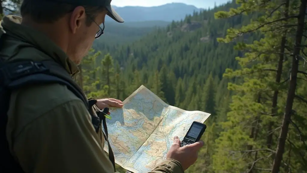
Locating on the UTM grid requires a methodical approach to guarantee precise positioning.
Grid navigation techniques involve understanding UTM coordinates, which are composed of easting and northing values. The easting value, such as 029 5103, indicates the distance east of the central meridian, while the northing value, such as 53 64712, represents the distance north. Each of the 60 UTM zones covers 6 degrees of longitude, providing a structured way to reference locations globally.
To accurately determine your position, first identify the relevant grid lines on your map. Measure the distances from these lines to ascertain your exact coordinates, enhancing your easting northing interpretation skills.
The central meridian for each UTM zone is set at 500,000 meters, serving as a vital reference point. Easting values below 500,000 indicate a location west of this line, aiding orientation.
Additionally, the bottom left corner of your map is significant, as it displays the starting point of the UTM grid and important grid line numbers. This understanding is essential for effective navigation and precise positioning, ensuring that you can confidently interpret and utilize UTM coordinates for reliable navigation in diverse environments.
Accurate Measurement Techniques

To guarantee precise positioning on a UTM grid, mastering accurate measurement techniques is imperative. These techniques involve the precise use of distance estimation and measurement tools. When working with a 1:50,000 scale map, precision is key.
Begin by measuring the distance east from the nearest grid line; for example, 103 meters. Next, measure the distance north from the other grid line, such as 712 meters. These measurements are essential for pinpointing your exact location on the grid.
For effective navigation, follow these steps:
- Use a Consistent Datum: Confirm your GPS datum matches the map's datum (e.g., NAD 27). Discrepancies can lead to errors exceeding 200 meters.
- Prioritize Easting Over Northing: Understand the UTM coordinate system by identifying easting values (e.g., 029 5103) before northing values (e.g., 53 64712).
- Overlay Compass Grid References: Utilize compass references on your map to enhance accuracy in locating your position.
Accurate measurement confirms reliable navigation. By integrating these techniques, you can confidently rely on your map and compass, minimizing GPS usage and conserving battery life, thereby maintaining a dependable navigation strategy.
Battery Conservation Strategies

Effective battery conservation strategies are critical for ensuring continuous GPS functionality during extended excursions. To optimize GPS battery life, it is imperative to adopt several key practices. Primarily, switch off your GPS device when not actively in use, especially when navigation efficiency does not require frequent location checks. This simple step markedly extends battery longevity during prolonged trips.
Utilizing the power-saving modes available on most GPS devices is another essential tactic. These modes typically reduce screen brightness and limit background processes, thereby decreasing energy consumption and prolonging device operation.
In addition, planning your route in advance and confirming your position using a map and compass can allow you to deactivate the GPS intermittently, thereby conserving battery power.
Carrying extra batteries or a portable charger is advisable for ensuring continuous operation without access to power sources. Understanding your GPS's battery consumption rates enables you to adjust your usage patterns, minimizing device activation time while maintaining safe navigation.
These strategies collectively enhance navigation efficiency by preserving GPS battery life, ensuring that your device remains functional throughout your journey. Implementing these measures is critical for maintaining reliable navigation support in remote or resource-limited environments.
Developing Navigation Skills

Optimizing battery life is one aspect of navigation, but developing thorough navigation skills is equally important for guaranteeing reliable and accurate journeys. Proficiency in navigation requires a seamless integration of GPS technology with traditional methods such as maps and compasses. This integration is essential across diverse navigation scenarios, from dense forests to open terrains.
To enhance your navigation skills, consider the following exercises:
- Datum Alignment: Familiarize yourself with geodetic datums. Confirm your GPS settings align with the map's datum to avoid errors. This technical precision is critical for accurate navigation.
- UTM Coordinates Mastery: Developing the ability to read Universal Transverse Mercator (UTM) coordinates, including easting and northing values, is fundamental. This skill enables precise location pinpointing on a map.
- Map Scale Proficiency: Regularly practice with a 1:50,000 scale map. This exercise refines your ability to judge distances and accurately determine your position using grid lines.
Additionally, conserving GPS battery by using it only for initial location confirmation promotes reliance on map and compass, fostering technological independence.
Frequently Asked Questions
How Can I Navigate With a Map and a Compass?
To navigate with a map and compass, align the map to true north considering compass declination. Identify your location, plot the course, determine the azimuth, and adjust for terrain, ensuring accurate land navigation by maintaining constant situational awareness.
How to Navigate at Night With Map and Compass?
Steering at night with a map and compass presents unique challenges. To maintain night vision, use a red-light headlamp. Confirm your compass is luminous, familiarize yourself with terrain landmarks, and practice triangulation for accurate positioning in low visibility.
How Do You Orienteer With a Map and Compass?
To effectively orienteer using a map and compass, first orient your map to true north with precise compass reading. Utilize land navigation skills to identify your position using grid coordinates and plan routes considering terrain features and elevation changes.
What Is It Called When You Use a Map and Compass?
The practice of using map reading and compass skills for navigation is known as orienteering. This technique involves precise interpretation of terrain features and calculated directional travel, enabling individuals to navigate effectively and accurately determine their position without technological reliance.
Conclusion
Integrating maps, compasses, and GPS devices optimizes navigation by leveraging the strengths of each tool. Traditional methods, such as map and compass, provide reliability and a deeper understanding of terrain, while GPS offers precision and convenience. Awareness of geodetic data and UTM grids enhances location accuracy. Accurate measurement techniques and battery conservation strategies further improve effectiveness. Developing thorough navigation skills guarantees successful outcomes in diverse environments, underscoring the importance of a multifaceted approach to navigation.